Rathen, Aberdeenshire
Rathen had established a parochial poorhouse or almshouse by the late 1860s. It was locally administered rather than operating as a statutory poorhouse under the central Board of Supervision.
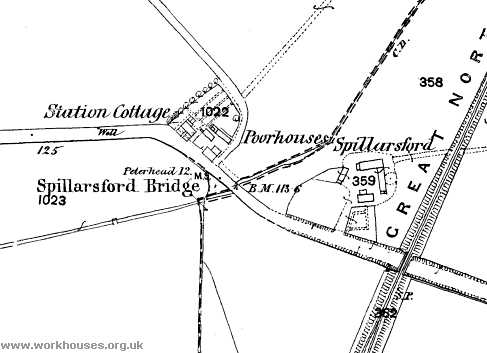
The poorhouse premises were located at Spillarsford Bridge to the north of Lonmay Station and are identified as poorhouses on the Ordnance Survey first edition map of around 1870. By the date of the second edition in approximately 1900, the area appears to have been redeveloped and the former poorhouses no longer exist.

Rathen poorhouses site, 1870.
The 1881 cenus identifies "paupers houses" in the parish at Memsie and Waulkmill, but not at Spillarsford.
Records
Note: many repositories impose a closure period of up to 100 years for records identifying individuals. Before travelling a long distance, always check that the records you want to consult will be available.
- Aberdeen City Archives, Town House, Broad Street, Aberdeen AB10 1AQ, and Old Aberdeen House, Dunbar Street, Aberdeen AB24 3UJ.
Unless otherwise indicated, this page () is copyright Peter Higginbotham. Contents may not be reproduced without permission.


