Kelso Combination, Roxburghshire
Paris Almshouses
A number of the parishes which were to become members of the Kelso Combination, also operated their own small almshouses or parochial lodging houses. These were locally administered rather than operating as statutory poorhouses under the central Board of Supervision.
In about 1846, the Duns Parochial Board purchased a property for used as a parish poorhouse or almshouse. In 1904, the parish's almshouse could accommodate up to 7 men, 5 women, and 3 children, superintended by a resident matron and servant.
According to the 1881 census, the parish of Chirnside had a local "poor house". In 1904, it was recorded that the parish had, for the previous ten years, been running a poorhouse accommodating up to 10 men, 10 women, and 12 children, superintended by a resident matron. It is not clear whether these references were both to the same establishment.
The 1881 census also refers to a "Poors House" on Haughhead Road in Earlston, a poor house near the police station at Stichill (also spelt Stitchill, Stitchel, etc.), a poorhouse at Aytonon the north side of the High Street in Ayton, and poorhouse on "Bow Street" (presumably The Bow) in Coldingham village. In 1904, it was recorded that the Coldingham poorhouse could accommodate up to 6 men, 6 women, and 6 children, superintended by a resident matron.
The Kelso Combination
The Kelso Combination (sometimes referred to as Kelso Union) initially comprised 23 parishes:
Roxburghshire:
Eckford, Ednam, Hownam, Kelso, Linton, Morebattle, Roxburgh, Smailholm, Sprouston, Stitchel, Yetholm.
Berwickshire: Coldstream, Duns, Earlston, Eccles, Edrom, Gordon, Greenlaw, Ladykirk,
Lauder, Legerwood, Nenthorn and Swinton.
Additional members in 1890 were: Chirnside, Coldingham and Hutton. By 1905, Fogo, Hume, Westruther, and Whitsome had also joined, but Coldingham had left.
The total population of the member parishes in 1881 was 29,603.
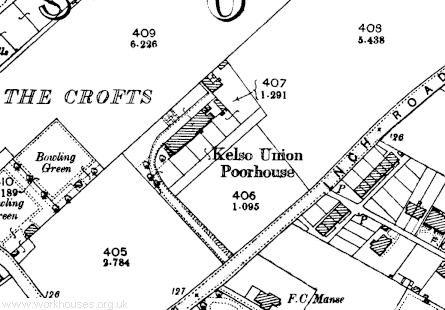
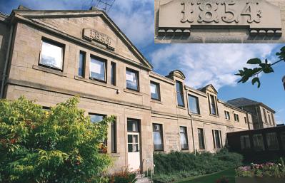
The Kelso Combination poorhouse was erected in 1854 at the north side of Inch Road at the north of Kelso. Unlike most other poorhouse buildings, Kelso comprised a single long block running east to west. The site location and layout are shown on the 1898 map below.

Kelso site, 1898

Kelso main block from the south, 2001.
© Peter Higginbotham.

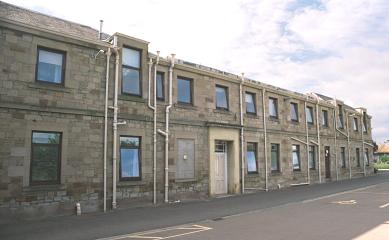
Kelso entrance from the north, 2001.
© Peter Higginbotham.
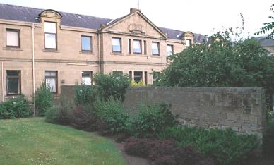
The ground along the south side of the poorhouse was divided into five yards for different categories of inmate.

Kelso dividing wall from the south, 2001.
© Peter Higginbotham.
The former poorhouse site is now the home of Kelso Hospital.
Staff
Inmates
Records
Note: many repositories impose a closure period of up to 100 years for records identifying individuals. Before travelling a long distance, always check that the records you want to consult will be available.
- Scottish Borders Archive and Local History Centre, Heritage Hub, Kirkstile, Hawick TD9 0AE. Holdings include various Kelso Union Poorhouse records (1854-1949).
Bibliography
- None.
Links
- None.
Unless otherwise indicated, this page () is copyright Peter Higginbotham. Contents may not be reproduced without permission.


