Kirkintilloch Combination, Dunbartonshire
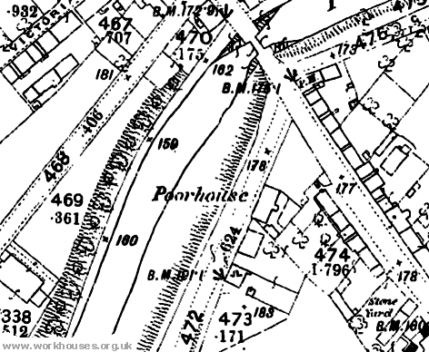
Kirkintilloch had a parish poorhouse from at least 1855. It was situated on Southbank Road, next to the Forth and Clyde Canal, and is identified as a poorhouse on the first edition Ordnance Survey map of 1859, but not on the second edition of 1898. In the 1881 census, there were three paupers in residence, together with the poorhouse matron.

Kirkintilloch poorhouse site, 1859.
The Kirkintilloch Combination was formed in around 1863 and comprised the parishes of: Campsie, Cumbernauld, and Kirkintilloch. Despite receiving approval for a poorhouse site and plans, none seems to have been set up, and the Combination appears to have disbanded in around 1873.
Campsie subsequently joined the Stirling Combination.
Inmates
Records
Note: many repositories impose a closure period of up to 100 years for records identifying individuals. Before travelling a long distance, always check that the records you want to consult will be available.
Bibliography
- None.
Links
- None.
Unless otherwise indicated, this page () is copyright Peter Higginbotham. Contents may not be reproduced without permission.


